The Best Android Navigation Apps of 2026
Written by: BestApp.com App Testing Team - Updated: Nov 05, 2021
Google Maps is the ultimate Android navigation app as it offers accurate online and offline maps, real-time traffic updates, shows you all nearby locations and points of interest, and lets you easily share your location and directions with others. But if you’re not happy with Google Maps, we found nine other great navigation apps for Android and iOS users. Here are the 10 best Android navigation apps available.
Top 10 Android Navigation Apps to Try
- Google Maps — Top Pick
- MapFactor — Best Free Version
- Waze — Best for Real-Time Traffic Updates
- MAPS.ME — Best for Travel
- HERE WeGo — Best for Route Customization
- Sygic GPS Navigation — Best Supplementary Features
- OsmAnd — Best for Terrain Data
- Polaris GPS Navigation — Best for Hikers
- BackCountry Navigator — Best for Off-Roading
- Scout GPS Navigation — Best Social Features
How We Chose the Best Navigation Apps
The best navigation apps provide everything users need to plan fast routes, avoid traffic jams, share their locations, and more. To create our list of the best Android navigation apps, we looked for apps that offer offline use, real-time traffic updates, walking directions, public transportation information, and downloadable maps.
Choose the navigation app that’s right for you
Most of the apps on our list are free and offer many of the same basic navigation features, meaning the best choice often comes down to personal preference. We recommend testing out multiple apps and reading user reviews to find the one with the features that best suit your wants and needs.
Download offline maps
Many of the navigation apps below offer offline maps to help users get around with no internet connection. When planning long road trips, download offline maps to make sure you don’t get lost if you happen to venture into an area with no service.
Our Android Navigation App Reviews
Google Maps — Top Pick
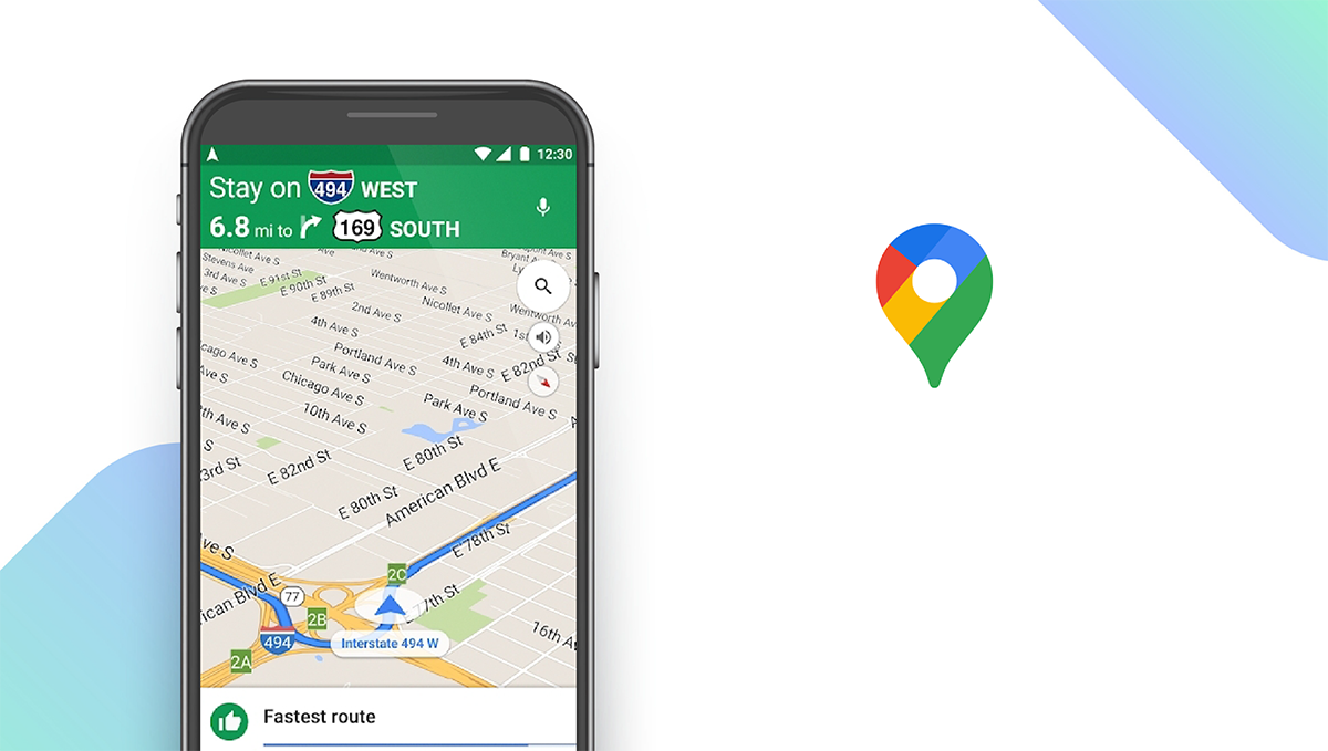
Google Maps is our top pick for the best overall navigation app on Android. Users can use Google Maps to plan routes, find public transportation, get walking and biking directions, get real-time traffic updates, and find nearby restaurants and gas stations. Unlike other navigation apps, Google Maps even lets you see a live view of your route so you can ensure you are on the right track. If your car has a digital dashboard, you can use Android Auto to view Google Maps on the dashboard. For users who are looking for something new to do, Google Maps offers curated lists of restaurants, activities, and points of interest to help them explore new areas.
Notable features:
- Free version available
- Subscription plans: None
- Support available: Help Center, Email, Community Help
| Google Maps Pros & Cons | |
|---|---|
| What we like | What we don’t like |
| Offline maps | Not ideal for off-road directions |
| Real-time traffic updates | |
| Lists all nearby locations | |
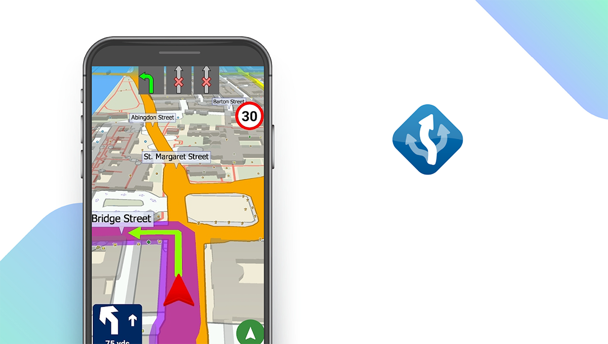
MapFactor — Best Free Version
Download: Android ★★★★★★★★★★ | iOS ★★★★★★★★★★
MapFactor is a great navigation app with a feature-rich free version. The free app includes access to free offline OpenStreetMaps that are regularly updated for accuracy, voice-guided GPS navigation, speed limits and camera warnings, nearby points of interest, and the ability to save your favorite routes for easy reference. MapFactor Navigator CAR Pro offers a wide range of additional features, including professional TomTom standard maps, live HD traffic, and remote commands. For most people, the free version offers everything you need to get around, though it does include some non-intrusive ads.
Notable features:
- Free version available
- Subscription plans: Pro: Contact for Pricing
- Support available: Email, Phone, FAQs, Forum, Videos & Manuals
| MapFactor Pros & Cons | |
|---|---|
| What we like | What we don’t like |
| Offline maps | Free version contains ads |
| Nearby points of interest | |
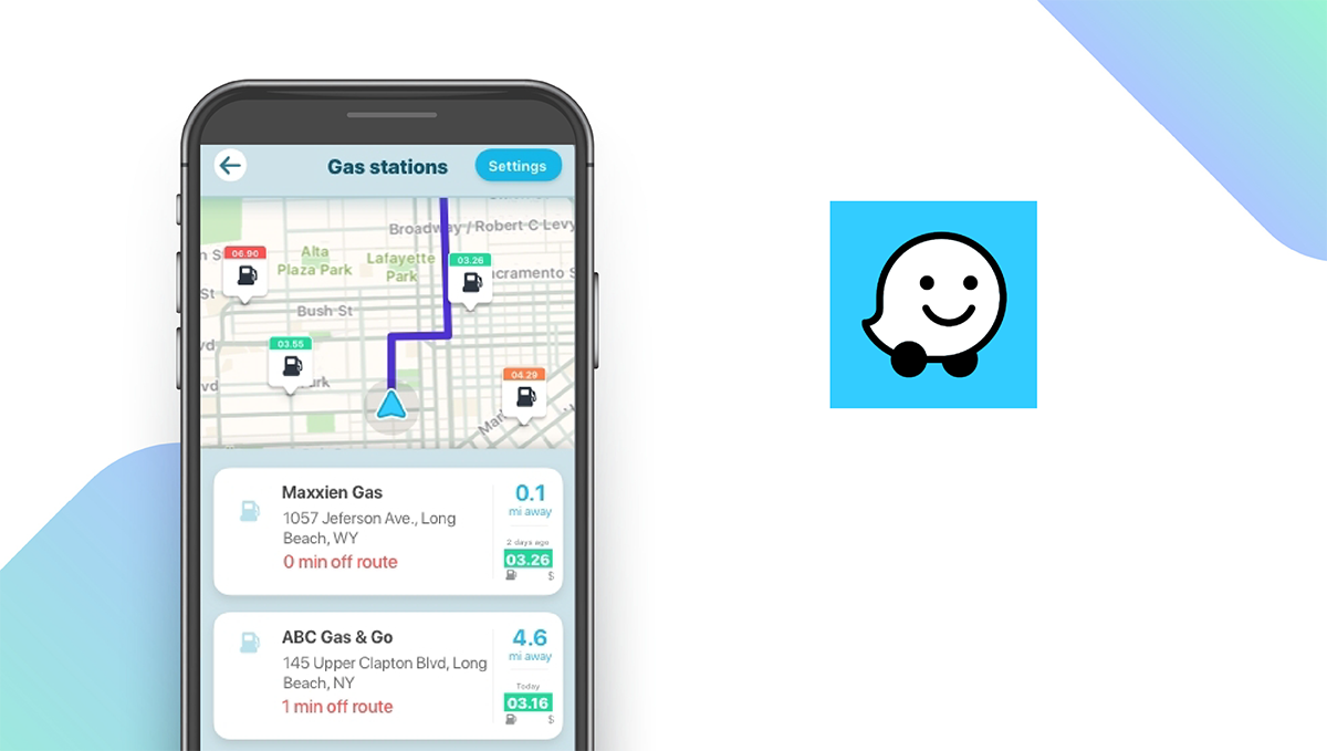
Waze — Best for Real-Time Traffic Updates
Download: Android ★★★★★★★★★★ | iOS ★★★★★★★★★★
Waze is the ultimate app for drivers who want to get accurate real-time traffic updates and find the fastest routes to their destinations in busy cities. Owned by Google, Waze tells you everything you need to know about your current route, including traffic, construction, police, and crashes. While driving, the app instantly changes your route to save time if a traffic jam comes up, and Waze shows you your expected arrival time based on live traffic data. Uniquely, you can control your favorite music and podcast apps right from Waze so that you don’t have to take your eyes off of the map. The app also helps you find cheap gas station prices along your route.
Notable features:
- Free version available
- Subscription plans: None
- Support available: Email, Help Center, Community Forum
| Waze Pros & Cons | |
|---|---|
| What we like | What we don’t like |
| Accurate real-time traffic updates | No offline use |
| Real-time route adjustments | No public transportation |
| Find nearby gas stations | |
MAPS.ME — Best for Travel
Download: Android ★★★★★★★★★★ | iOS ★★★★★★★★★★
MAPS.ME is the best app on our list for travelers as it offers access to high-quality offline maps for locations around the world. Offline maps offer turn-by-turn navigation for driving, walking, or bicycling, and they include detailed directions to nearby points of interest, including hiking trails. One feature that makes MAPS.ME stand out is its detailed collection of travel guides for hundreds of destinations around the world. Travelers can also make hotel bookings with Bookings.com directly through the app, and you can search for nearby restaurants, cafes, hotels, ATMs, and more. If you’re walking or cycling, you can also view whether or not your planned route is uphill or downhill.
Notable features:
- Free version available
- In-app purchases: $0.99 – $39.99 per item
- Support available: Email
| MAPS.ME Pros & Cons | |
|---|---|
| What we like | What we don’t like |
| Offline maps for global locations | Limited support options |
| Detailed travel guides | |
| Hotel bookings | |
HERE WeGo — Best for Route Customization
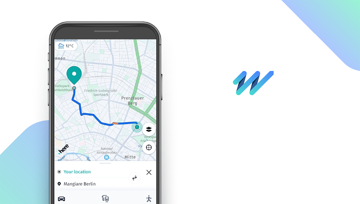
Download: Android ★★★★★★★★★★ | iOS ★★★★★★★★★★
HERE WeGo is often touted as the best alternative to Google Maps and is a great choice for users that want to create their own custom routes. Unlike similar apps, users can input their own shortcuts to create faster routes, and you can save collections of your favorite places for quick access to directions. The app provides detailed directions for driving or walking and helps users find nearby public transportation. Once at your destination, HERE WeGo will help you find parking spots. To further customize your route, you can also add waypoints, and the app will automatically adjust your route to include your added destinations. To save mobile data, you can download maps for offline use.
Notable features:
- Free version available
- Subscription plans: None
- Support available: Email, FAQs/Help
| HERE WeGo Pros & Cons | |
|---|---|
| What we like | What we don’t like |
| Route customization | Doesn’t include nearby points of interest |
| Lists public transportation options | |
| Downloadable maps | |
Sygic GPS Navigation — Best Supplementary Features
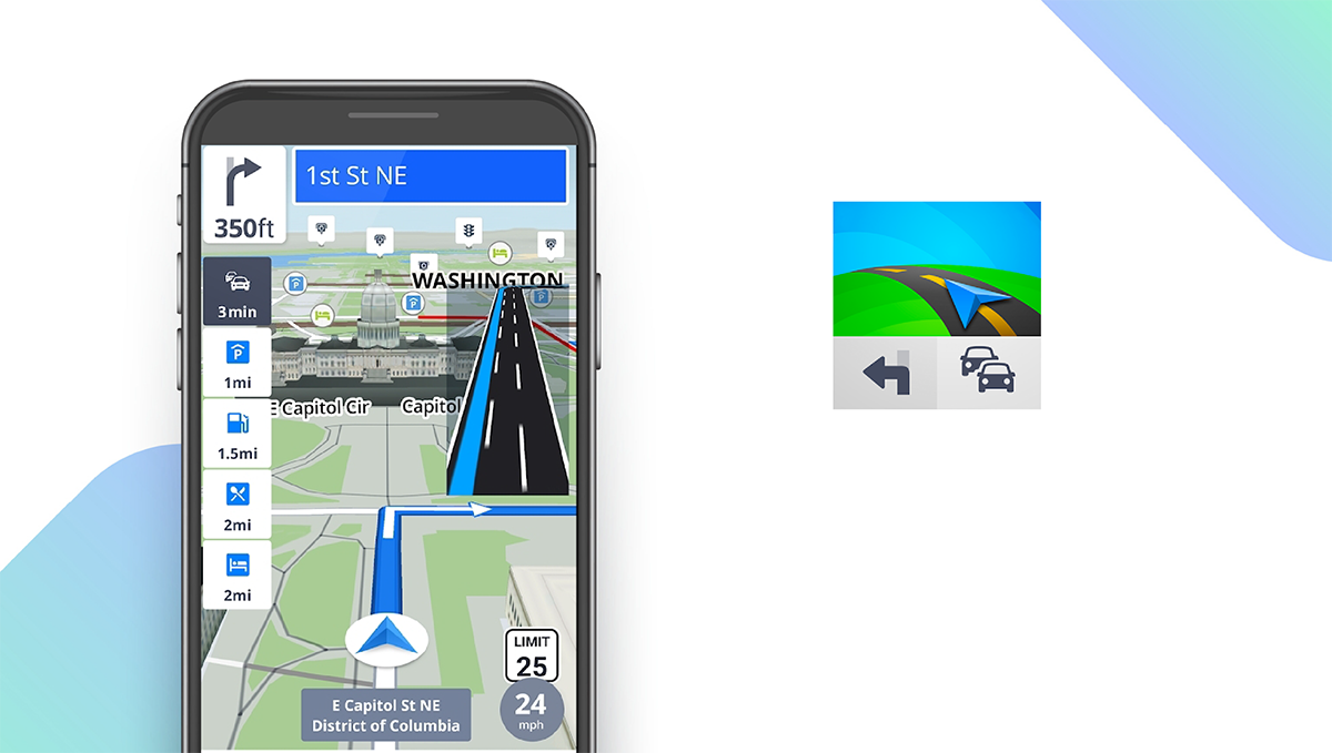
Download: Android ★★★★★★★★★★ | iOS ★★★★★★★★★★
Sygic GPS Navigation is an incredibly feature-packed navigation app with several useful tools to help you while you’re on the road. The app includes many basic navigation features, including turn-by-turn directions, offline maps, voice-guided GPS navigation, nearby points of interest, and walking directions. What makes Sygic stand out are its supplementary features, like its Dashcam that records the road in front of you in case of an accident. The Cockpit feature shows you real-time information about your car’s performance, and the Dynamic Lane Assistant guides you to the correct lane while you drive. The app also provides speed limit warnings, helps you find affordable gas prices, and suggests nearby parking places.
Notable features:
- Free version available
- Subscription plans: Premium+ 3-Month subscription: $12.49
- Support available: Help Center, Email
| Sygic GPS Navigation Pros & Cons | |
|---|---|
| What we like | What we don’t like |
| Dashcam feature | Limited support options |
| Offline maps | |
| Suggests parking locations | |
OsmAnd — Best for Terrain Data
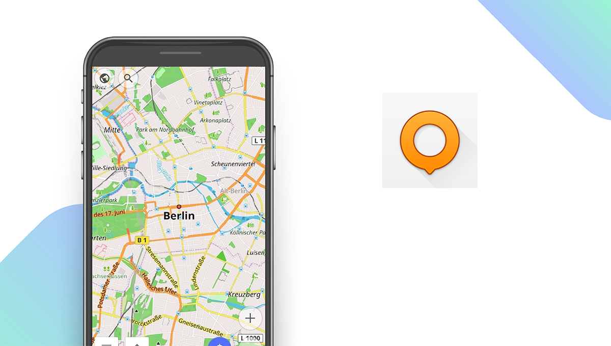
Download: Android ★★★★★★★★★★ | iOS ★★★★★★★★★★
OsmAnd Maps offers maps from OpenStreetMap with hourly updates to ensure they are always up-to-date. Users can get directions, view offline maps, edit maps, record their trips, search for nearby locations, and view street-level imagery for more detailed directions. Unlike many other navigation apps, OsmAnd lets you view accurate terrain data, making it easier to plan hiking and off-roading routes. The app includes other unique tools, like a radius ruler and compass, to make measuring distances easy, and users can easily share their locations with their friends.
Notable features:
- Free version available
- Subscription plans: Start at $2.99 per month
- Support available: Email, Help Center/FAQs, Forum, Documentation
| OsmAnd Pros & Cons | |
|---|---|
| What we like | What we don’t like |
| Accurate terrain data | No live customer support |
| Offline maps | |
| Map editing | |
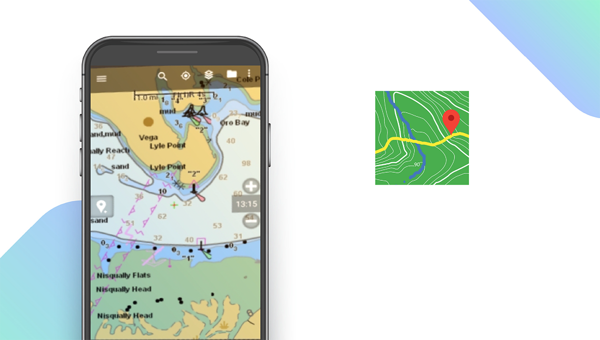
Polaris GPS Navigation — Best for Hikers
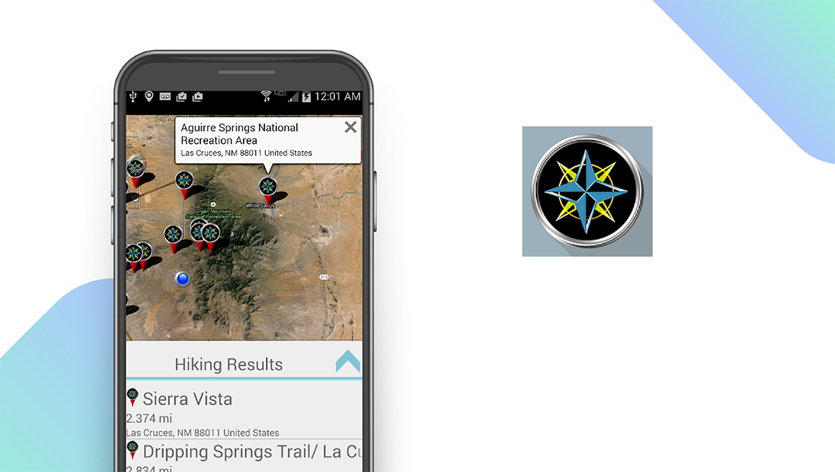
Download: Android ★★★★★★★★★★
Polaris GPS Navigation is the perfect navigation app for hikers and outdoors enthusiasts as it is designed to help users navigate remote areas. Users can download free raster and vector maps, design custom map layers, customize GPS reporting, and share their location with others for safety. The app even includes nautical charts for sailing. The Polaris Places Picker helps users find interesting places to explore, and navigation tools that typically aren’t included in similar apps, like a compass and radar, make navigation easy. There are several map types available, including Google maps, topographic maps, and marine charts. The app also provides basic turn-by-turn directions for driving, and users can download an unlimited number of offline maps.
Notable features:
- Free version available
- In-app purchases: $0.99 per item
- Support available: Email
| Polaris GPS Navigation Pros & Cons | |
|---|---|
| What we like | What we don’t like |
| Maps for remote areas | Limited support options |
| Navigation tools | |
| Unlimited offline map downloads | |
BackCountry Navigator — Best for Off-Roading
Download: Android ★★★★★★★★★★
Like Polaris, BackCountry Navigator is a navigation app designed primarily for outdoors enthusiasts. The app is particularly useful for off-roading thanks to its unique ATV trail maps. It also includes whitewater maps, equestrian trail maps, and offline topographic maps for hiking. You can use GPS waypoints from GPX or KML files or enter their own coordinates. You can also create your own maps with Mobile Atlas Creator. The app costs $14.99 to download, and additionally, several resources are available for purchase, including the Accuterra Topo Map Source for $19.99 per year and the Thunderforest Map Sources for $7.99 per year.
Notable features:
- Free version not available
- In-app purchases: $3.99 – $24.99 per item
- Support available: Email
| BackCountry Navigator Pros & Cons | |
|---|---|
| What we like | What we don’t like |
| ATV trail maps | Excessive in-app purchases |
| Offline topographic maps | Costs $15 to download |
Scout GPS Navigation — Best Social Features
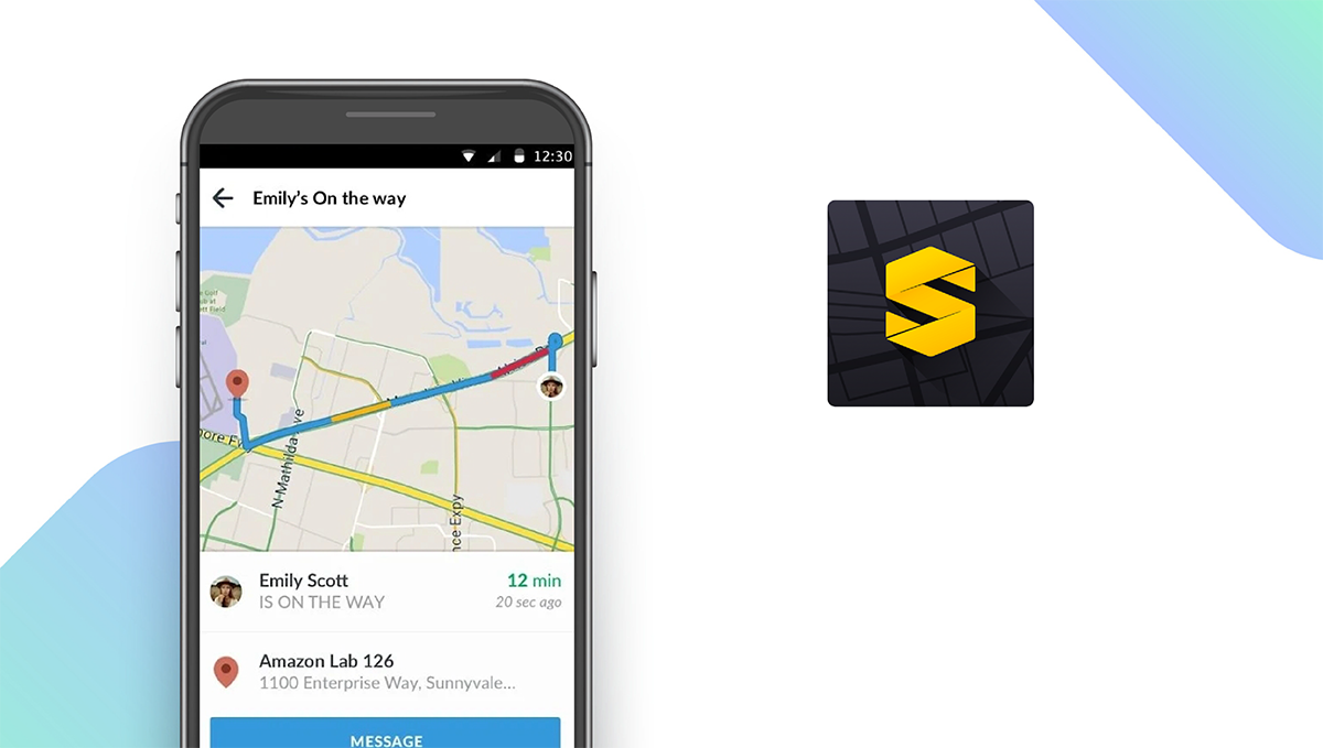
Download: Android ★★★★★★★★★★ | iOS ★★★★★★★★★★
Scout GPS Navigation is a feature-rich navigation and maps app that delivers high-quality social features not found in other apps. Users can easily share their location and ETA with their contacts with a single tap, and you can view nearby restaurants and points of interest recommended by other users. Aside from these social features, Scout GPS offers many of the same basic navigation capabilities you would expect, including live traffic updates, the ability to save favorite locations, walking directions, and the app helps you find the lowest nearby gas prices.
Notable features:
- Free version available
- Subscription plans: Scout Plus: $4.99/month
- Support available: Help Center, Email, Community Forum, Tickets
| Scout GPS Navigation Pros & Cons | |
|---|---|
| What we like | What we don’t like |
| Greta social features | No public transportation |
| Real-time traffic updates | |
| Walking directions | |
Android Navigation Apps: Features Summary Table
| Android Navigation Apps Comparison Table | ||
|---|---|---|
| App | Subscription Fees or In-App Purchases | Features |
| Google Maps — Top Pick | None | ✓ Offline Use ✓ Real-Time Traffic Updates ✓ Walking Directions ✓ Public Transportation ✓ Downloadable Maps |
| MapFactor — Best Free Version | Pro: Contact for Pricing | ✓ Offline Use ✓ Real-Time Traffic Updates ✓ Walking Directions X Public Transportation ✓ Downloadable Maps |
| Waze — Best for Real-Time Traffic Updates | None | X Offline Use ✓ Real-Time Traffic Updates ✓ Walking Directions X Public Transportation X Downloadable Maps |
| MAPS.ME — Best for Travel | $0.99 – $39.99 per item | ✓ Offline Use ✓ Real-Time Traffic Updates ✓ Walking Directions ✓ Public Transportation ✓ Downloadable Maps |
| HERE WeGo — Best for Route Customization | None | ✓ Offline Use ✓ Real-Time Traffic Updates ✓ Walking Directions ✓ Public Transportation ✓ Downloadable Maps |
| Sygic GPS Navigation — Best Supplementary Features | Premium+ 3-Month subscription: $12.49 | ✓ Offline Use ✓ Real-Time Traffic Updates ✓ Walking Directions ✓ Public Transportation ✓ Downloadable Maps |
| OsmAnd — Best for Terrain Data | Starts at $2.99 per month | ✓ Offline Use X Real-Time Traffic Updates ✓ Walking Directions ✓ Public Transportation ✓ Downloadable Maps |
| Polaris GPS Navigation — Best for Hikers | $0.99 per item | ✓ Offline Use X Real-Time Traffic Updates ✓ Walking Directions X Public Transportation ✓ Downloadable Maps |
| BackCountry Navigator — Best for Off-Roading | $3.99 – $24.99 per item | ✓ Offline Use X Real-Time Traffic Updates ✓ Walking Directions X Public Transportation ✓ Downloadable Maps |
| Scout GPS Navigation — Best Social Features | Scout Plus: $4.99/month | ✓ Offline Use ✓ Real-Time Traffic Updates ✓ Walking Directions X Public Transportation ✓ Downloadable Maps |