The Best Apps for Hikers of 2026
Written by: BestApp.com App Testing Team - Updated: Aug 31, 2021
When it comes to the best apps for hikers, AllTrails earns our top pick as it is the ultimate source for trail maps, reviews, and descriptions. With these resources, AllTrails makes it as easy as possible to plan your next hike. But if AllTrails doesn’t meet your needs, we found several other great hiking apps that help outdoor enthusiasts get the most out of their adventures. Here are the best apps for hikers to try.
Top Apps for Hikers to Try
- AllTrails — Top Pick
- Gaia GPS — Best Free Version
- onX Backcountry — Best Maps
- Cairn — Best for Hiking Safety
- PeakVisor — Best for Mountain Identification
- Guthook Guides — Best for Thru-Hiking
- Hiking Project — Best for Finding New Points of Interest
- Seek by iNaturalist — Best for Plant Recognition
- PeakFinder AR — Best for Identifying Peaks
- National Park Trail Guide — Best for Hiking in National Parks
- SAS Survival Guide — Best for Learning Survival Skills
How We Chose the Best Apps for Hikers
To find the best apps for hikers, we focused on four key features: maps, GPS capabilities, distance tracking, and offline availability. These features help hikers plan their trips and stay safe while hiking in areas with spotty cell service. We also looked at apps that offer unique features that enhance the hiking experience, like identifying plants, wildlife, and mountain peaks.
Choose the hiking app that’s right for you
Finding the right hiking app depends largely on the type of hiking you do. AllTrails, for example, is great for casual hikers and enthusiasts alike that want to find popular trails near them, while apps like Guthook Guides are tailored towards thru-hikers and those interested in longer trails. Consider what type of hikes you’re interested in before choosing one of the apps on our list.
Safety first
When hiking, whether on populated trails near city centers or on more rural trails, it’s important to put safety first to prevent yourself from getting lost or experiencing any accidents. Many of these apps have hike planning features that you should use to ensure you are familiar with your trail before embarking. While most of these apps offer offline capabilities, it’s always a good idea to bring tools, like compasses and maps, to help you stay on track in case you aren’t able to access your hiking app.
Our Hiking App Reviews
AllTrails — Top Pick
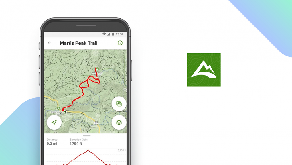
Download: Android ★★★★★★★★★★ | iOS ★★★★★★★★★★
AllTrails is one of the most popular hiking apps available and is our top pick as the best overall app for hikers. AllTrails makes it easy to find new trails, get directions, read reviews, and read trail details from other hikers. These descriptions include details like whether or not a trail is pet-friendly, elevation, length, and more. While the free version is great for casual hikers, enthusiasts will likely prefer to pay for Pro, which provides several unique features, like the ability to download maps for offline use, for $29.99 per year. This subscription includes safety features, like Lifeline, which lets your friends and family know where you are, and the app tracks your GPS location while you hike to help you stay on track.
Notable features:
- Free version available
- Subscription plans: Pro: $29.99/year
- Support available: Email, Help Center, Ticket
| AllTrails Pros & Cons | |
|---|---|
| What we like | What we don’t like |
| Detailed trail descriptions | Best features locked behind subscription |
| Able to search trails by tags | |
| Great social features | |
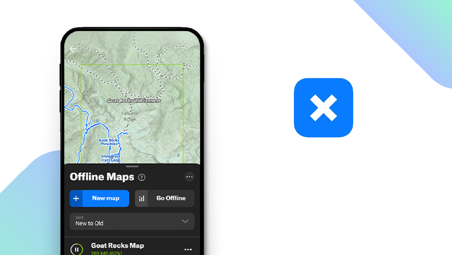
Gaia GPS — Best Free Version

Download: Android ★★★★★★★★★★ | iOS ★★★★★★★★★★
Gaia GPS is a popular hiking app for navigation, and its free version offers several great features that are commonly locked behind the subscription services of other similar apps. Gaia GPS’ free plan lets users plan routes, record tracks, discover trails, add waypoints, and view virtual topographic maps. For $39.99 per year, you can upgrade to Premium and unlock other great features, including offline maps, specialty maps for certain countries, air quality maps, wildfire condition maps, and mountain biking maps. The app also generates a trip stats report after your hike for a more detailed look at your journey.
Notable features:
- Free version available
- Subscription plans: Premium: $39.99/year
- Support available: Help Center
| Gaia GPS Pros & Cons | |
|---|---|
| What we like | What we don’t like |
| Great free plan | Offline use limited to Premium version |
| Generates trip stats reports | Limited customer support options |
| Includes a built-in compass | |
onX Backcountry — Best Maps
Download: Android ★★★★★★★★★★ | iOS ★★★★★★★★★★
The free version of onX Backcountry includes plenty of helpful features for hikers, including custom waypoints, localized weather reports, and 24K topography and satellite maps. There’s also a GPS tracking feature that allows you to record the speed, distance, and duration of your hikes. By upgrading to an onX Backcountry Membership, you’ll unlock extra features such as offline mode, public land boundaries, and a guidebook that lists over 54,000 campsites and 450,000 points of interest. If you’d like to try out these bonus features before you commit to a purchase, there’s a free trial available that provides you with full access to the app for seven days.
- Free version available
- Subscription plans: $29.99 for initial year, $39.99/year for renewal
- Support available: Ticket, FAQs
| onX Backcountry Pros & Cons | |
|---|---|
| What we like | What we don’t like |
| Accurate, high-definition maps | No live customer support |
| Detailed weather reports | |
| No ads, even with free version | |
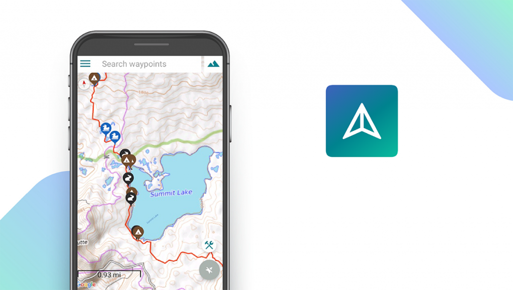
Cairn — Best for Hiking Safety
Download: Android ★★★★★★★★★★ | iOS ★★★★★★★★★★
Cairn is considered by many to be an essential app for safe hiking. Some of the app’s standout features include real-time location sharing, downloadable offline maps, trail status updates (e.g. sunset alerts), and past-due notifications that alert your safety contacts when you’re on a trail for longer than expected. The app also maps out areas with cell reception and lists ETAs for hikes. For certain key features, like location sharing and offline use, you’ll have to upgrade to premium for $26.99 per year, while the free version offers basic features like maps and trails.
Notable features:
- Free version available
- Subscription plans: Premium: $26.99/year
- Support available: Email, FAQs
| Cairn Pros & Cons | |
|---|---|
| What we like | What we don’t like |
| Real-time location sharing | Key features are locked behind Premium |
| Status updates | |
| Safety notifications | |
PeakVisor — Best for Mountain Identification
Download: Android ★★★★★★★★★★ | iOS ★★★★★★★★★★
Whereas most of the apps on this list are designed to help users plan hikes, PeakVisor aims to help you get the most out of your hikes by identifying mountain peaks. You simply open the app, point your camera at a peak, and the app uses image data and your GPS location to identify the peak and provide additional information, like altitude. The app even advises photographers on the perfect time to take a picture of a given mountain peak. The free version of the app lets you access most of its features, but to use the app offline you have to upgrade to Pro for $3.49 per month.
Notable features:
- Free version available
- Subscription plans: Pro: $3.49/month
- Support available: Email
| PeakVisor Pros & Cons | |
|---|---|
| What we like | What we don’t like |
| 3D compass and altimeter measure peak altitude | Offline use requires Pro subscription |
| Identifies mountain peaks anywhere in the world | Limited customer support options |
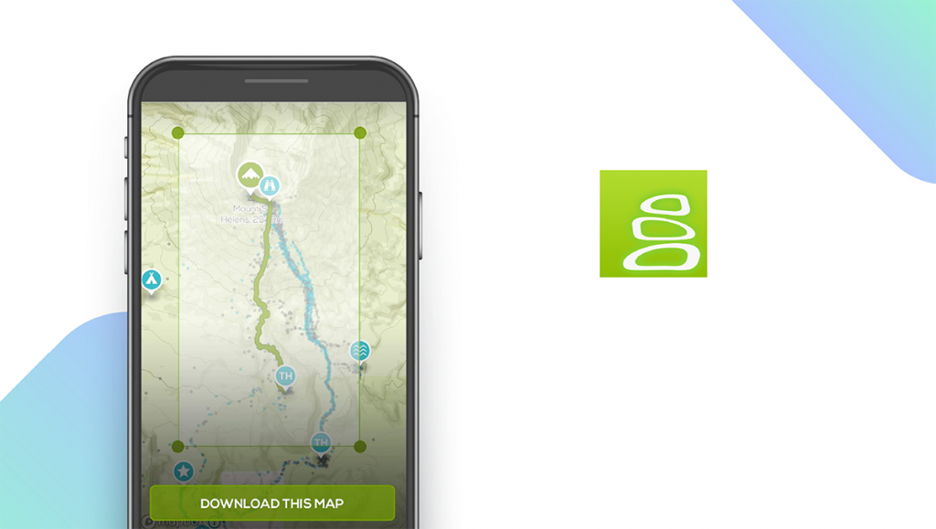
Guthook Guides — Best for Thru-Hiking
Download: Android ★★★★★★★★★★ | iOS ★★★★★★★★★★
Guthook Guides is one of the most popular apps available for long-distance and thru-hikers. The app helps users discover hikes, trails, and wilderness regions across the world and features hiking guides to help users get the most out of their trips. Trail maps are GPS-enabled and can be downloaded for offline use. For each hike, you’ll find information like campsite locations, water sources, elevation, and distance. The app is free to use, but you’ll have to pay for each individual hiking guide (prices vary). It also offers a unique custom trail-building feature for hikers that want to forge their own paths.
Notable features:
- Free version available
- In-app purchases: $1.99 – $59.99 per item
- Support available: Email, FAQs
| Guthook Guides Pros & Cons | |
|---|---|
| What we like | What we don’t like |
| Comprehensive guides for thru-hikes | In-app purchases can be expensive |
| Campsite and water source locations | |
Hiking Project — Best for Finding New Points of Interest

Download: Android ★★★★★★★★★★ | iOS ★★★★★★★★★★
Hiking Project is a crowd-sourced hiking app that offers detailed descriptions of trails based on user-provided information. The app is very similar to AllTrails with the unique addition of ‘Gems’ — points of interest along each trail. Users can sort trails by popularity or search by region or trail features. Before starting your hike, you can view detailed descriptions, including reviews, trail conditions, and wildlife that you can find during your hike. The app does not require any subscription or in-app purchases, making it a great free alternative to AllTrails.
Notable features:
- Free version available
- Subscription plans: None
- Support available: Help Center, FAQ, Email
| Hiking Project Pros & Cons | |
|---|---|
| What we like | What we don’t like |
| Completely free to use | No distance tracking |
| Detailed trail descriptions | |
Seek by iNaturalist — Best for Plant Recognition

Download: Android ★★★★★★★★★★ | iOS ★★★★★★★★★★
One of the great things about hiking is being able to enjoy new environments, including wildlife and plant life. Seek by iNaturalist is an image recognition app that allows users to identify plants and wildlife while on their hikes. If you come across a plant or animal that you don’t recognize, open the app and take a photo of the subject, then the app will identify it and provide additional information about the species. Users can earn badges and achievements as they discover new species. Seek is completely free to use and does not require an account to get started, making it a great and free way to enhance your hikes.
Notable features:
- Free version available
- Subscription plans: None
- Support available: Help, FAQs, Email, Forum, Guides & Tutorials
| Seek by iNaturalist Pros & Cons | |
|---|---|
| What we like | What we don’t like |
| Free to use | App requires very clear images to work |
| Accurate plant and animal identification | |
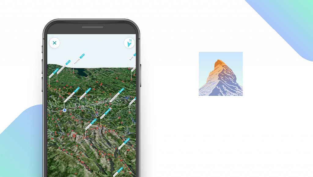
PeakFinder AR — Best for Identifying Peaks

Download: Android ★★★★★★★★★★ | iOS ★★★★★★★★★★
PeakFinder AR is a peak identification app similar to PeakVisor. Users can use the app’s built-in camera to identify any mountain peak they come across on their hikes. The app uses a 360-degree panoramic camera to capture amazing images of peaks and mountain ranges. What makes PeakFinder stand out from PeakVisor is the app’s built-in photo editor and ‘teleportation’ feature, which allows users to get a bird’s-eye view of any mountaintop. Users can tap on mountain names to bring up additional information about the peak. PeakFinder costs $4.99 to download, but there are no in-app purchases or subscription fees.
Notable features:
- Free version not available
- Subscription plans: None
- Support available: Email, FAQs
| PeakFinder AR Pros & Cons | |
|---|---|
| What we like | What we don’t like |
| One-time purchase | No free version available |
| Built-in photo editor | |
| AR capabilities | |
National Park Trail Guide — Best for Hiking in National Parks
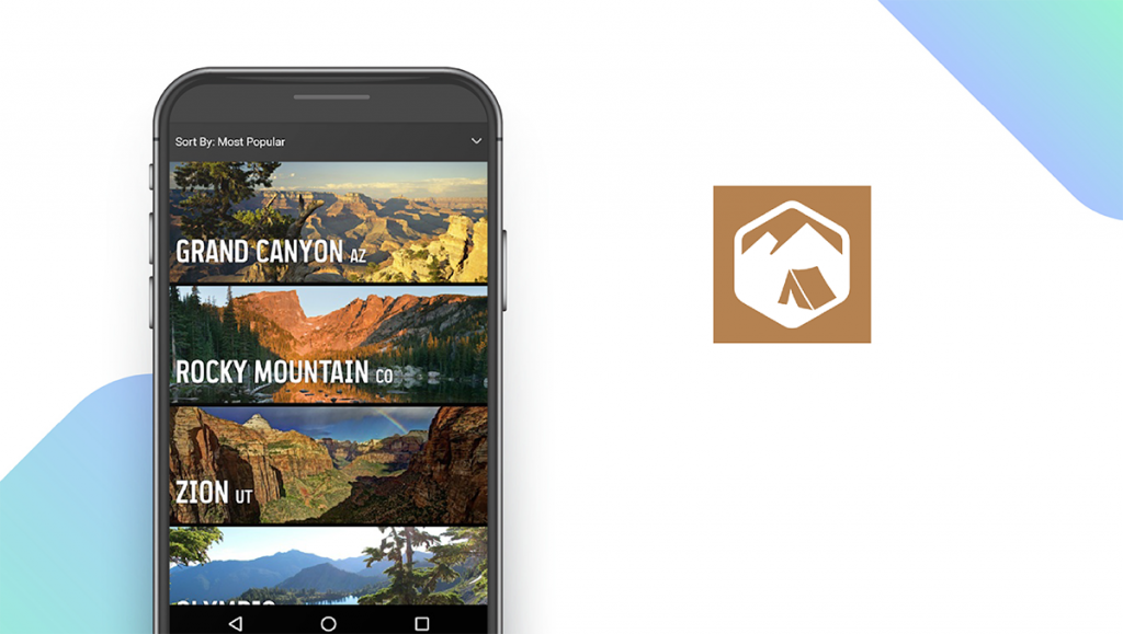
Download: Android ★★★★★★★★★★ | iOS ★★★★★★★★★★
Whereas most of the trail-finding apps on our list focus on providing trail details for hikes around the world, National Park Trail Guide aims to provide comprehensive hiking guides for US national parks. The app gives users detailed trail descriptions, including campsite locations, difficulty ratings, guided tour information, lodging options, food and drink sources, and more. The app includes a ‘best of’ list for users to find the most highly-rated hikes in any given national park, and the app is completely free to use with no subscription plans or in-app purchases.
Notable features:
- Free version available
- Subscription plans: None
- Support available: Email, FAQs, Help Center, Live Chat, Phone
| National Park Trail Guide Pros & Cons | |
|---|---|
| What we like | What we don’t like |
| Completely free to use | No distance tracking |
| Detailed trail descriptions | |
| Comprehensive trail guides | |
SAS Survival Guide — Best for Learning Survival Skills
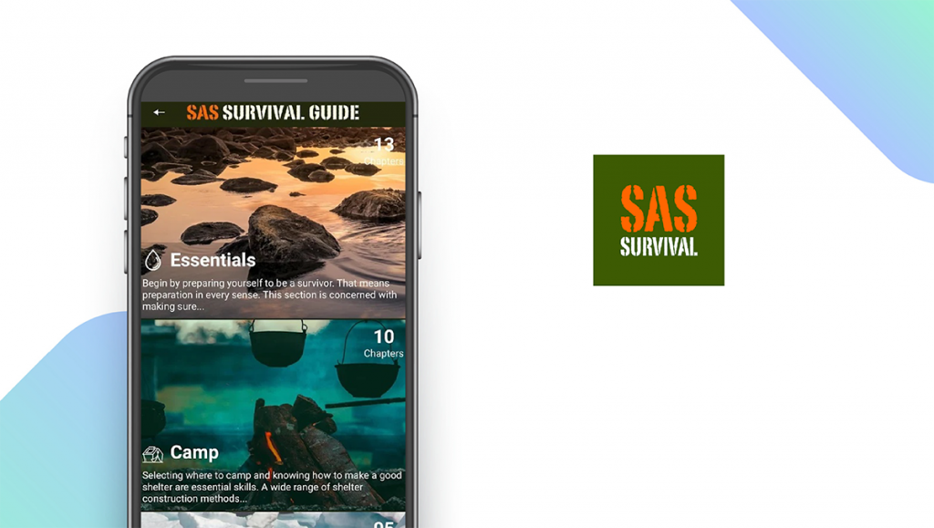
Download: Android ★★★★★★★★★★ | iOS ★★★★★★★★★★
This app is an accompaniment to the best-selling book that has been printed and reprinted for over 20 years. Unlike other apps on our list that are designed to help users plan hikes, SAS Survival Guide focuses on teaching relevant survival skills that help hikers stay safe while in the wilderness and take care of themselves if they get lost. This includes how to safely camp, how to make a solar compass, how to handle snake bites and other animal dangers, and more. The app can be used offline, and it includes video lessons to help users understand more complex survival topics. The app costs $5.99 to download and does include in-app purchases.
Notable features:
- Free version not available
- In-app purchases: $3.99 per item
- Support available: Email
| SAS Survival Guide Pros & Cons | |
|---|---|
| What we like | What we don’t like |
| Teaches relevant survival skills | No free version |
| Includes video lessons | In-app purchases on top of purchase price |
Hiking Apps: Features Summary Table
| Hiking Apps Comparison Table | ||
|---|---|---|
| App | Subscription Fees | Features |
| AllTrails — Top Pick | Pro: $29.99/year | ✓ Maps ✓ GPS ✓ Offline Use ✓ Distance Tracking |
| Gaia GPS — Best Free Version | Premium: $39.99/year | ✓ Maps ✓ GPS ✓ Offline Use ✓ Distance Tracking |
| onX Backcountry — Best Maps | Membership: $29.99 for initial year, $39.99/year for renewal | ✓ Maps ✓ GPS ✓ Offline Use ✓ Distance Tracking |
| Cairn — Best for Hiking Safety | Premium: $26.99/year | ✓ Maps ✓ GPS ✓ Offline Use ✓ Distance Tracking |
| PeakVisor — Best for Mountain Identification | Pro: $3.49/month | ✓ Maps ✓ GPS ✓ Offline Use ✓ Distance Tracking |
| Guthook Guides — Best for Thru-Hiking | $1.99 – $59.99 per item | ✓ Maps ✓ GPS ✓ Offline Use ✓ Distance Tracking |
| Hiking Project — Best for Finding New Points of Interest | None | ✓ Maps ✓ GPS ✓ Offline Use X Distance Tracking |
| Seek by iNaturalist — Best for Plant Recognition | None | X Maps X GPS ✓ Offline Use X Distance Tracking |
| PeakFinder AR — Best for Identifying Peaks | None | ✓ Maps ✓ GPS ✓ Offline Use X Distance Tracking |
| National Park Trail Guide — Best for Hiking in National Parks | None | ✓ Maps ✓ GPS ✓ Offline Use X Distance Tracking |
| SAS Survival Guide — Best for Learning Survival Skills | $3.99 per item | X Maps X GPS X Offline Use X Distance Tracking |
✓